Offline Mobile GIS Redlining
Transform how technicians interact with GIS data by allowing them to mark inaccuracies or updates directly on their mobile maps, even offline!
Challenges
Technicians often heavily rely on maps and multiple GIS (Geographic Information System) data when working in the field. These maps provide critical information about the locations of assets, infrastructure, terrain, and other relevant spatial data. However, the real world is dynamic, with new infrastructure being built, land transformed, and geography evolved, so that lots of GIS data can become outdated.
Let’s suppose that a utility company manages a vast network of pipelines and transmission lines for delivering water, gas, and electricity to various regions.
Field technicians heavily rely on GIS maps to track the location and attributes of these assets.
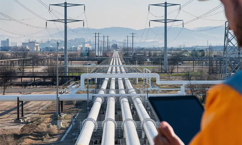
But what happens if new gas pipelines are integrated into the network? When technicians arrive in the field, they encounter discrepancies between the map and the actual infrastructure on the ground. This misalignment can lead to confusion, inefficiencies, and potential safety concerns.
The same happens when technicians arrive in the field to inspect wind turbines and discover that the landscape has changed due to recent weather events, leading to shifts in terrain, vegetation patterns, and potential hazards.

Until now, when technicians have encountered inaccurate GIS data, they have needed to document any changes on paper, email, or other inefficient ways and communicate it to the back office for updating. The back office would be required to pinpoint the exact location and figure out what and how to update the data to reflect the current situation in the field. It could take weeks or longer for GIS data to get updated, reviewed, and published back out to the technicians.
Offline mobile GIS redlining feature
The solution
The offline mobile GIS redlining feature gives technicians the possibility to mark the inaccuracies or changes needed directly on the map, based on what they actually see in the field.
They can access the GIS map on their mobile devices and compare it with the actual infrastructure they encounter.
If they identify any discrepancies or changes, they can use the redlining feature to mark the updated information directly on the map.
So, if a new gas pipeline has been installed, technicians can draw the pipeline’s path on the map and attach relevant information.
The updated data is then passed over to the back office for review, significantly improving the time needed to get GIS data updated and back in field technicians’ hands.
Users capture real-time observations, annotate changes, updates, corrections, and notes directly on the map, that can be shared with others. These live updates ensure accuracy, boost operational efficiency, and enhance safety measures.
Adding annotations, notes, and images to the map to indicate the changes technicians observe. This ensures that the map’s accuracy is constantly being improved and new information is integrated promptly.
Entering information right at the point of observation directly on the map. This reduces the likelihood of errors and ensures accurate and up-to-date records.
Sharing annotated maps with colleagues and back-office team, instantly. This facilitates better communication, as everyone involved can access the most recent field observations and updates, ensuring that all stakeholders rely on the latest information to work.
Enhancing collaboration among field teams, engineering, and back-office staff. Annotations made on the map provide clear visual context to reduce misunderstandings and promote seamless teamwork.
Offline capability
Technicians working in remote or challenging environments where constant connectivity is not guaranteed, often struggle with accessing up-to-date maps and data, which can hinder their ability to perform essential tasks and respond to issues effectively.
To address this challenge, the feature includes robust offline capabilities. Technicians can continue to updatinge and annotatinge maps even without an Internet connection. These offline edits are seamlessly synchronized with the central system once connectivity is restored, ensuring that no valuable observations are lost, and that all data remains current.
Impact & KPIs
Streamlining field operations
Fostering collaboration across the organization
Expediting field data collection
Saving time and costs